AI Vision for Smarter, Safer Cities.
Inkryptis AI helps municipalities and urban authorities monitor public spaces, pedestrian and vehicle flows, and infrastructure usage in real time — turning city-wide sensor data into actionable insight for planning, safety, and resource allocation.
Pedestrian & Crowd Flow Monitoring
Measure pedestrian movement and crowd density across public squares, transit hubs, and parks in real time.
Pedestrian Count (In/Out)
Crowd Density Levels
Peak Hour Trends
Dwell Time in Public Spaces
Total Area Occupancy


Traffic & Vehicle Analytics
Monitor vehicle flow, detect congestion, and analyse junction performance across city road networks.
Vehicle Counting & Classification
Real-time Congestion Detection
Junction & Lane Flow Analysis
Public Safety & Anomaly Detection
Identify overcrowding and unusual activity early to keep public spaces safe and responsive.
Crowd Density Alerts
Unusual Behaviour Detection
Restricted Zone Monitoring



Transit & Passenger Insights
Track station and stop occupancy to optimise public transport capacity and scheduling.
Passenger Count (In/Out)
Platform & Stop Occupancy
Boarding & Alighting Trends
Space Utilization & Urban Planning
Understand how civic facilities and public areas are used to guide smarter city planning decisions.
Utilization by Area & Time
Facility Occupancy Trends
High & Low Activity Zones


Privacy-First Edge Analytics
Process vision data anonymously on-device to meet public privacy and compliance requirements.
Anonymous On-Device Processing
No Personal Data Stored
Compliance-Ready Deployment
Centralized City Dashboard
Bring every location and sensor together in one enterprise analytics suite for city-wide visibility.
Multi-Location Analytics
Custom Reports & Exports
Powered by V9 Analytics Suite

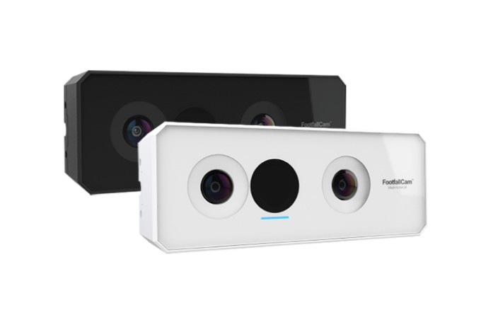
3D Pro
AI-Powered 3D Stereo Vision People Counter

FaceCam
AI-Powered Demographics Analysis Sensor

Staff Tags
Staff Exclusion Accessories to differentiate staff footfall.

V9 Analytics suite
Enterprise security Software Analytics Suite